Discover BURLINGAME HISTORY

Becoming Burlingame
During the 1930s, taking advantage of the public works programs offered by the Depression-era New Deal, Burlingame at Rhode Island State Park became home to the 141st Company of the Civilian Conservation Corps. It was the first of five such camps in Rhode Island and acted as the state's headquarters. Beginning in 1933, out of work young men in their late teens and early twenties were put to work making many roads and trails. In addition, they built fireplaces, campsites, and picnic areas, while making recreational improvements to the beaches of Watchaug Pond. Forest management activities went on throughout Rhode Island, particularly in the aftermath of the Hurricane of ’38 which downed thousands of trees and disrupted roads and public improvements.


Burlingame land use in the 1940s-50s.
The CCC was disbanded in 1942 because of the overwhelming need to draft manpower for WW II. In the course of the War, because of its proximity to the Charlestown Naval Air Station, Burlingame was used to house Naval personnel. At other times, it was an Army camp, and a rest stop for British Navy personnel. It even did duty as a prisoner of war camp. Following the war, a portion of the park served the American Legion as a youth summer camp. “Legion Town” re-used facilities employed by the CCC from 1946 until 1961. For a long time, all the Christmas trees used at the State House holiday season came from Burlingame at Rhode Island State Park.
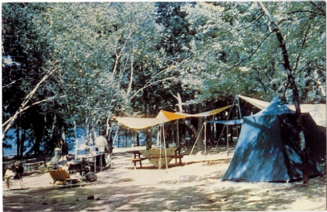
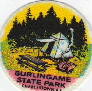
Burlingame State Campground History
For nearly two centuries, 1702 to 1902, there was only one main road along the Atlantic coast of Rhode Island, the Boston Post Road, familiar to modern Rhode Islanders as Scenic 1A. Begun as a postal route to connect New York and Boston, the Post Road ran by way of ferry connections through Newport, or took the mainland road up the west side of Narragansett Bay through Wickford, East Greenwich, Apponaug, Pawtuxet to Providence. The coastal road not only connected Westerly to Narragansett, but it separated the flat meadow lands and salt ponds of Charlestown and South Kingstown from the woody, rock-strewn uplands that led towards the river systems of the Pawcatuck and Wood.
In the 18th century the broad strip of meadow lands stretching from Point Judith to Westerly was the home of the Narragansett Planters, the large farms of the Robinson, Hazard, Helmes, Champlin, Babcock, Burdick, and Stanton families. These were mostly livestock farms: sheep herds, cattle, and the famous Narragansett Pacer horses. The shoreline crescent of sandy barrier beaches backed by a necklace of salt ponds went largely unappreciated for its recreational qualities until late into the 19th century when people from out of state began to rent summer homes and set up tent communities to enjoy the pleasures of the sea. At either end of this strand were the formal resort hotel destinations of Westerly’s Watch Hill and Narragansett Pier.
When the state park system for Rhode Island was created in 1904, the Atlantic coast was beyond the scope of the Metropolitan Park Commission. The Commission at first sought to bring recreational relief to the Providence urban core and nearby population centers. Some twenty-five years later, however, the original concept of a ring of parks around Providence, connected by scenic parkways, was expanded to the shores and woods of Rhode Island’s South County. The expansion, however, focused not initially on the barrier coastal beaches, but on the woody, rocky northern fringe of Route 1.

Following the lead of the Audubon Society’s creation of the Kimball Wildlife Sanctuary in Charlestown, in 1927, the Metropolitan Park Commission began acquiring woodland around Watchaug Pond, leading to the establishment of Burlingame Reservation, and, ultimately, Burlingame State Park and Campground. The making of the state park resulted from assembling adjacent parcels, either by direct purchase or through condemnation. One of the purchases was that of a private club lodge and 498 acres of land. Under the terms of the purchase of Chomowauke Lodge, full ownership of the property was not transferred to the state until 1960. United States Senator, Theodore Francis Green, was the last private member to join in September of 1930 and the last to pass away. At first, in 1930, the land was just a wildlife preserve. By 1934, it was opened as Burlingame State Reservation, or state park.

The 3100 acres evolved into the state’s first camping ground. It was named after the Commission’s long-standing chair, Edwin A. Burlingame. Beginning in 1991 a four-phase upgrade of the camping sites, sanitary infrastructure and maintenance amenities was undertaken. Using a combination of National Park Service grants and the state’s Recreation Area Development Funds much needed improvements to facilities, some dating back to the 1930, commenced. Other public funds from the Federal Environmental Protection Agency and DEM have been used to study the yearly cycle of Watchaug Pond so that the cleanliness of the pond can be observed and maintained. The area north of Buckeye Brook Road, abutting the Pawcatuck River, is primarily a hunting area.

WATCHAUG POND
Watchaug Pond i Charlestown is a 573 acre kettle pond and one of the largest freshwater lakes in Rhode Island. Much of Watchaug Pond is within Burlingame Management Area, but the southern and eastern shores have some houses along them. Watchaug Pond is popular in the summer months, so except in the early morning, it is likely to be a busy place, especially at the southeast end. The marshy western end feels more remote and wild. The pond is stocked with trout in the early spring. Watchaug Pond has an average depth of only 8 feet and the deepest location is 36 feet deep. Jet skis are not permitted on Watchaug Pond, but canoeing, kayaking, motorboats and water-skiing are permitted. There are lifeguards stationed at the beach and swimming areas located at Burlingame Campground and the State Park. Boat launch ramps are located within the campground, as well as on Sanctuary Road near Prosser Trail. An 8½ miles walking trail wraps around the pond's exterior, passing through Burlingame and the Kimball Wildlife Refuge.
VIN GORMLEY TRAIL
The Vin Gormley Trail in Charlestown is a long woodland hike with a side trip into a wildlife refuge. This hike runs through the Burlingame Management Area, a 3,100-acre park first opened in 1934, and the Kimball Wildlife Refuge, one of the Audubon Society of Rhode Island’s protected areas. The complete Vin Gormley Trail is an 8.0-mile loop-around all of Watchaug Pond in Burlingame and includes more than 2 miles of walking on paved roads with narrow shoulders. This trip includes a substantial portion of the yellow-blazed Vin Gormley Trail but skips most of the blacktop and tacks on a side ramble into the 29-acre Kimball Wildlife Refuge. It was in the 1980's that Vin Gormley began maintaining an 8½ mile trail around Watchaug Pond, known then as the Yellow Trail. It had been originally built in the 1960's by the Youth Conservation Corps for the Department of Environmental Management. In the summer 1991 issue of "Watershed", Vinny was quoted as saying "If I live to be a 100, I won't have that trail the way it should be." Vin used diseased pine trees that had to be cut, loaded 12 foot sections into his trailer and hauled them to spots near the low areas. After stripping each log of it's bark, he built bog bridges. (Lots of them!) In 1991, by an act of legislature, the trail's name was changed to the John Vincent Gormley Trail. Each September, the AMC trails committee schedules maintenance on the Gormley Trail in Vinny's memory. Vin is forever part of Burlingame State Campground history.

B4B's PRIVATE FB GROUP...
Our 3.1K+ members will answer questions, give opinions & recommend a great campsite! Our CAMPER CREATED community allows you gain access to decades of combined knowledge and experience. Answer membership questions and agree to rules to have your account screened for entry. #campershelpingcampers